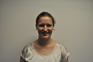
Bluestone spent a great deal of time with FEMA's GIS team. She observed it as its cross-country members spent their 12-hour shifts compiling power outage data from the Eastern Seaboard in nearly real time. Bluestone also interacted with the team members involved in the data compilation process.
That process entailed amassing multiple datasets on power failures into a common database that FEMA could use to make large-scale maps that could portray the situation every 15 minutes to planners and first responders. Her hands on experience with GIS mapping software at START made her feel at home with the team at FEMA.
"Watching the GIS mapping in action was exciting because I was able to see an almost real-time application of my profession," Bluestone said.
"It also inspired me in many ways with regards to what we are doing at START."
Bluestone was also invited to sit in on several important briefings that included top members of several agencies, the military, local governments, weather stations and specialists from Homeland Security.
"It was inspiring to see so many people with different backgrounds all pitching in," she said. "It was all very chaotic but clear that they were doing as much as they could to keep up with storm."
Bluestone initially became engaged in geospatial science to fulfill her personal passion of environmental conservation. But, working at START opened her eyes to the other ways that science can be applied, such as to the study of terrorism and responses to terrorism.
"I've found it very exciting to be able to take the specialty that I've always wanted to work with, and apply it to current defense oriented research," Bluestone said.
Bluestone is currently a START researcher, serving a primary role in expanding START's GIS capabilities. Though her career might be on a different track than she had envisioned, it's clear her interest in GIS has not wavered.
"Geospatial data can help us expand on our current research and analysis in two ways: it can give us an added dimension to our qualitative data by placing it on a coordinate system and finding relations in a spatial context, and not just a theoretical one. GIS can also enhance research by drawing connections to other sets of data that would not normally appear related," Bluestone said.
"There is so much information out there that, when put in the correct context with what you're working on, can shed a whole new kind of light on things."
